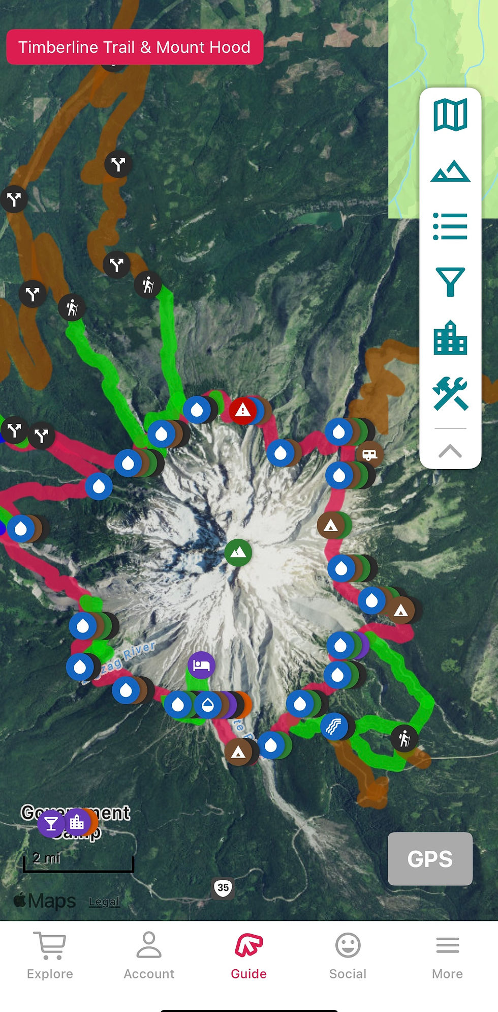
FarOut App: The Backpacker’s BFF
- tmschales
- Jul 10
- 3 min read
Check it out: https://alnk.to/hDskV2G
Whether you're gearing up for a thru-hike on the Appalachian Trail or planning your next section hike along the Pacific Crest Trail, having a reliable navigation and trail guide app can make or break your journey. I use several mapping apps for various activities; FarOut, (formerly known as Guthook Guides) — is the go-to app for long-distance backpackers worldwide.
🧭 What Is FarOut?
FarOut is a trail navigation and planning app built specifically for hikers tackling long-distance routes. It offers downloadable trail guides packed with waypoints, campsites, water sources, elevation profiles, user comments, and offline GPS functionality. Once you've downloaded your guide, you’re good to go—even with no cell service.
Popular trails include:
Pacific Crest Trail (PCT)
Appalachian Trail (AT)
Continental Divide Trail (CDT)
Camino de Santiago
Te Araroa (New Zealand)
The Timberline Trail

🔍 Key Features
✅ Trail-Specific Offline Guides
Each trail guide includes maps, elevation profiles, and thousands of data points; all features are accessible offline AFTER you’ve downloaded the sections (You gotta do this BEFORE you hit the trail).
✅ Real-Time, Crowd-Sourced Updates
For me, this is the most valuable function. Hikers can leave comments on trail conditions, water sources, water crossings, closures, or resupply info — often updated within hours or days. Often I find the app to have more current information than ranger stations (I still check with rangers though).
✅ Checkpoints and Social Features
Send your GPS location to friends and family (when you regain signal), track your progress, and stay connected with other hikers on the trail.
✅ Planning Tools
Use custom route planning, mileage tracking, and elevation chart views to map out each day’s mileage and resupply points.
🟢 What Sets it Apart?
Unmatched Trail Data: No other hiking app has the depth of community-sourced content that FarOut provides.
Offline Navigation: Works flawlessly in airplane mode, *provided you download your guide beforehand.
Trusted by the Community: It’s the gold standard on trails like the PCT and AT.
“FarOut by a million miles… FarOut is the only answer.” — Experienced PCT hiker on Reddit

💰 Pricing
FarOut is free to download, but trail guides are sold individually:
Short trails: $5–$15
Long trails: Up to $75
Unlimited Access: ~$15/month, $72/season, or $96/year
I find the value of the information to be worth the cost. FarOut frequently runs seasonal sales, or specials on certain trails if you follow them on social media.
🛠️ Pro Tips for Using FarOut on Trail
Download Everything Before You GoMaps, photos, user comments—get it all while you’re still on Wi-Fi.
Always Carry a BackupWhether it’s Gaia GPS, Garmin GPX files, or Caltopo—never rely solely on one digital tool in the backcountry.
Carry a paper map. And compass. And know how to use them. Apps are amazing, but phones go swimming, fall off cliffs, and of course die. Using a phone as a camera, music, etc. AND relying on it for your routing is a recipe for dead phone disaster.
If you're hitting a long trail and want near real-time intel from thousands of hikers who’ve walked before you, FarOut is worth every penny—just plan ahead and stay flexible.
Check it out: https://alnk.to/hDskV2G


Comments